Subject: Eastern Mediterranean & Middle East
Period: 1624 (published)
Publication: Theatri Orbis Terrarum Parergon
Color: Hand Color
Size:
13.9 x 10.6 inches
35.3 x 26.9 cm
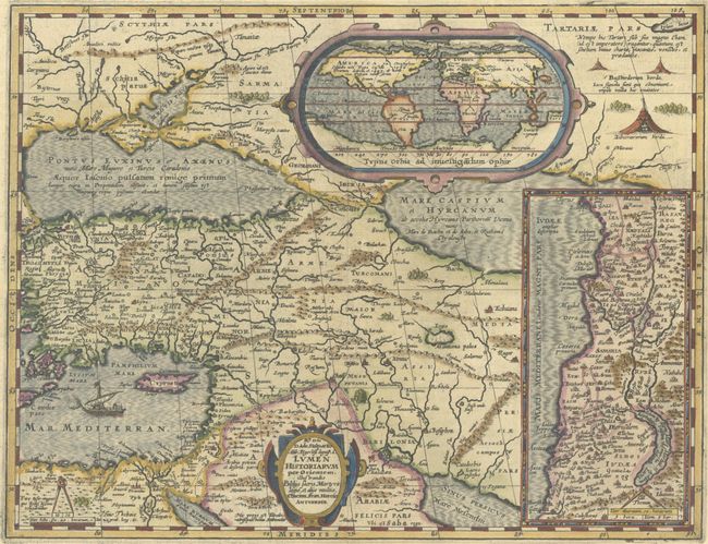
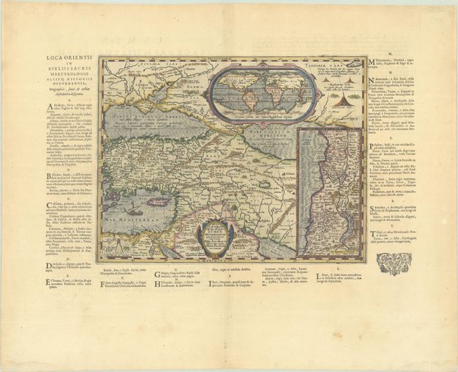
Beautifully engraved map of the region from the eastern Mediterranean to the Persian Gulf based on the work of Frans van Haren. The map extends through Turkey and the Caucasus to include the region north of the Black Sea. Details include the pyramids in Egypt, the route of Abraham from Ur to Sichem, and the wandering of the Children of Israel. At top is an inset map of the world, showing a large southern continent, a Northwest Passage, and distorted outlines to North and South America. Another inset map of the Holy Land is shown at the right. Frans van Haren (more commonly called Haraeus) was a theologian, historian, globe maker and mapmaker from around 1615 to 1624. He prepared two maps centered on the Mediterranean Sea for Ortelius' classical atlas that described the world known to the ancients. The map is surrounded with columns of text with an alphabetical listing of place names occurring in the bible and other holy writings. With the text, the image measures 19 x 12". Latin text on verso. This map is scarce, as it only appears in two editions of the Theatrum.
References: Van den Broecke #184.
Condition: A
A sharp impression on a bright sheet with a small coat of arms watermark and marginal soiling.