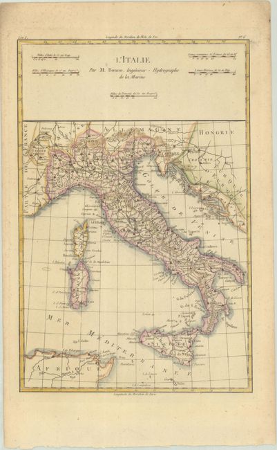
Subject: Italy
Period: 1780 (circa)
Publication: Atlas de Toutes les Parties Connues du Globe Terrestre
Color: Hand Color
Size:
8.3 x 12.6 inches
21.1 x 32 cm
Copper engraved map of Italy showing political divisions, cities, towns and topography. The map covers the area from Switzerland, across to Hungary and Croatia, and south to the tip of Africa. Corsica, Sardinia, and the Gulf of Venice are shown, and Sicily features a tiny erupting Mt. Etna. There are five distance scales flanking the title above the map.
Rigobert Bonne was an important French cartographer of the late 18th century. In 1773 he succeeded Jacques Bellin as the royal cartographer in the office of the Hydrographer at the Depot de la Marine. Working in his official capacity, Bonne compiled some of the most detailed and accurate maps of the period.
References:
Condition: A
A crisp impression with a hint of toning and marginal soiling.