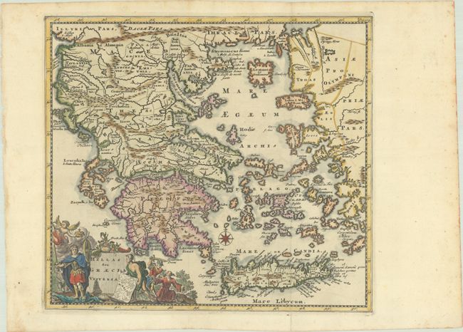
Subject: Greece
Period: 1729 (published)
Publication: Introductionis in Universam Geographiam
Color: Hand Color
Size:
10.1 x 9.1 inches
25.7 x 23.1 cm
This attractive small map covers the historic regions of Greece, Crete, and the Aegean Sea. It is filled with detail and adorned with an allegorical title cartouche and a compass rose.
Cluver's Introductio in Universam Geographicam was a popular atlas, appearing in over 45 editions during a 100-year period. The first edition was published without maps in the 1620s, and the first edition to include maps was published circa 1641. The various editions were published in different cities throughout Europe, including Amsterdam, Nuremberg, and London, often with new sets of maps engraved. This map is from an edition published in Amsterdam by Joannem Pauli with maps by Jan Wolters.
References: Shirley (BL Atlases) T.CLUV-8b; Zacharakis #627.
Condition: A
A crisp impression, issued folding with an arms of Amsterdam watermark and a small hole along the coast of Turkey.