Catalog Archive
Auction 204, Lot 509
Rare English Text Edition
"Walachia Servia, Bulgaria, Romania", Mercator/Hondius
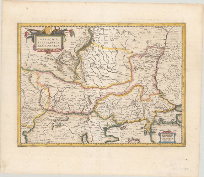
Subject: Eastern Balkans
Period: 1636 (published)
Publication: Gerardi Mercatoris et I. Hondii Atlas
Color: Hand Color
Size:
18.5 x 13.7 inches
47 x 34.8 cm
Download High Resolution Image
(or just click on image to launch the Zoom viewer)
(or just click on image to launch the Zoom viewer)