Subject: Southeastern Europe
Period: 1573 (published)
Publication: Theatrum Orbis Terrarum
Color: Hand Color
Size:
19.1 x 13.1 inches
48.5 x 33.3 cm
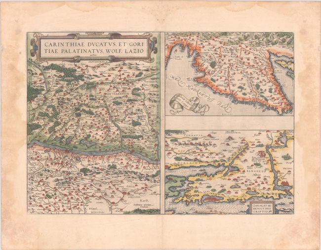
This folio sheet contains three maps. At left is a large map based on the cartography of Wolfgang Lazius. It is centered on Villach on the Drau River in the region bordering Austria and Slovenia. At top right is a detailed map of the Istria Peninsula and the Gulf of Trieste based on Petro Coppo's map of 1569. Below is a map of the region around Zara and Sebenico from an anonymous map first published by Paulo Forlani. The maps are minutely detailed with mountains, woods, rivers and lakes, cities, ancient ruins, and even bridges. Published in the first Dutch edition in 1573.
References: Van den Broecke #143.
Condition: B+
Full contemporary color with the crossed arrows watermark commonly found on Ortelius maps and wide, original margins. There are dampstains in the blank margins, one of which enters 0.5" into map image at left. There is some paper weakness in bottom corners of sheet, not affecting map.