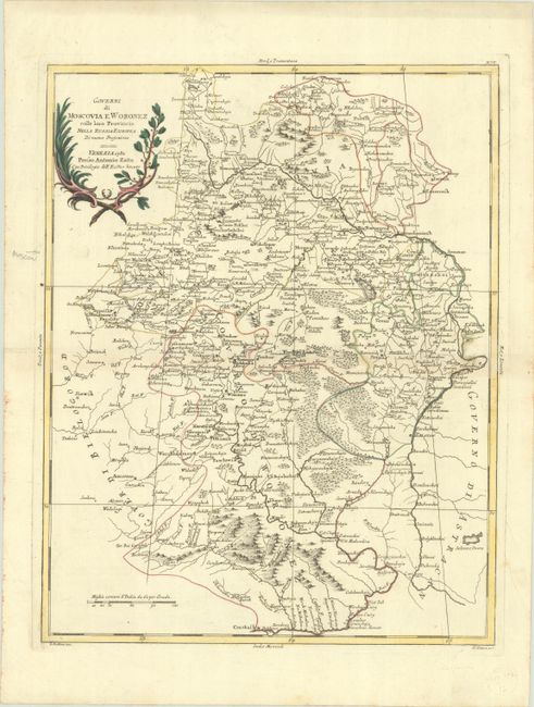
Subject: Southwestern Russia
Period: 1782 (dated)
Publication: Atlante Novissimo
Color: Hand Color
Size:
13.1 x 16.8 inches
33.3 x 42.7 cm
This detailed map illustrates the region between Moscow, Kostroma, and Volgograd. Political boundaries, towns, rivers and mountains are well depicted. Engraved by G. Pitteri.
Antonio Zatta was one of the leading Italian cartographers and publishers of the time, and his Atlante Novissimo was one of the most beautifully produced 18th-century atlases. He drew on the work of contemporary cartographers including Robert de Vaugondy and Bellin, and developed his own distinctive elegant style.
References: Shirley (BL Atlases) T.ZAT-1a Vol. 2 #33.
Condition: A
A crisp impression with full contemporary color on a sheet with a three crescent moons watermark. There is minor toning along the centerfold and a pair of tiny wormholes in the right blank margin.