Subject: Eastern Europe, Russia
Period: 1574 (published)
Publication: La Geografia di Claudio Tolomeo Alessandrino
Color: Black & White
Size:
9.4 x 7 inches
23.9 x 17.8 cm
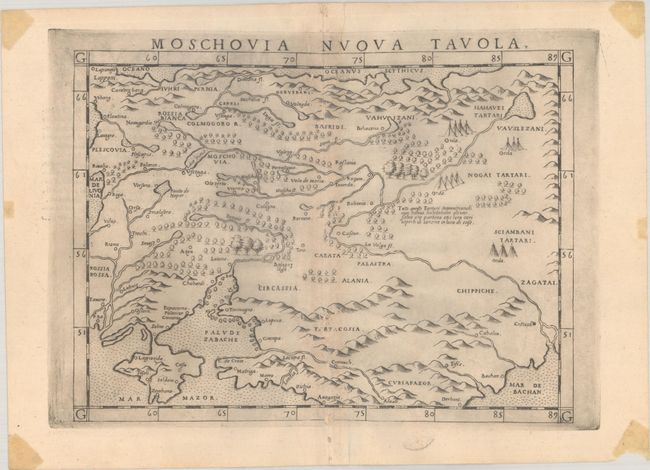
This early map of Russia includes portions of present-day Latvia and Lithuania, Belarus, and Ukraine. It spans from Vyborg, Riga, Vilnius east to where the Volga empties into Mar de Bachan (Caspian Sea), with Moscow and Kazan roughly at center. The map is filled with pictorial representations of topography as well as small tents to represent Tartar camps. Italian text on verso with large historiated letter "L."
References: Mickwitz & Miekkavaara #220-53.
Condition: B+
A nice impression with some short wormtracks along the centerfold that have been infilled with archival materials on verso. There is a printer's crease at top, printer's ink residue, and tape stains in the corners, well away from map image.