Subject: Eastern Czech Republic
Period: 1720 (circa)
Publication:
Color: Hand Color
Size:
22.6 x 18.4 inches
57.4 x 46.7 cm
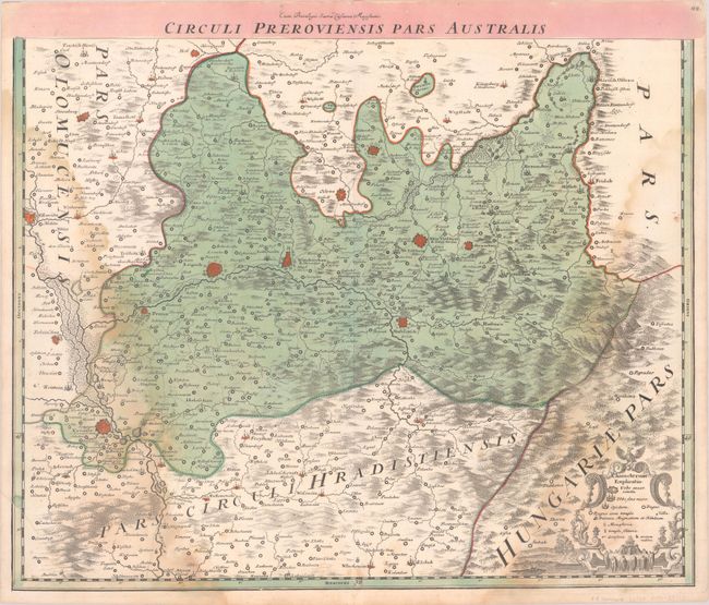
This densely-engraved two-sheet map shows the eastern portion of present-day Czech Republic, including the cities of Ostrava, Olomouc and Prerov. Fortified cities are shown as miniature bird's-eye plans, and roads, political boundaries, forests, and mountains are also depicted. The southern sheet includes a legend, and the northern sheet features a large title cartouche flanked by a pair of River gods.
References:
Condition:
Both sheets have nice impressions with full contemporary color on sturdy sheets with the watermark of Elias Kutter. The northern sheet is in "B+" condition with light toning along the centerfold and a minor repaired tear in the bottom margin. The southern sheet is in "B" condition with dampstaining in the image.