Catalog Archive
Auction 204, Lot 465

"Bohemia in suas Partes Geographice Distincta", Kaerius/Jansson

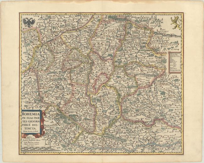
Subject: Czech Republic

Period: 1630 (dated)

Publication:

Color: Hand Color

Size:
18.5 x 16 inches
47 x 40.6 cm
Download High Resolution Image
(or just click on image to launch the Zoom viewer)

This superb map of the history region of Bohemia centers on Prague. It is fully engraved with rivers, mountains, forests, castles, monasteries, fortified towns, hot springs, bridges, ferries, and roads. The map was prepared by Petrus Kaerius and published by Jansson. It also appeared with a carte-a-figures border, which is very rare. French text on verso, published in 1633.

References: Van der Krogt (Vol. I) #2850:1B.2.

Condition: A

A sharp impression on a bright sheet with dampstains along the edges of the sheet and remnants of framing tape on verso.

Estimate: $300 - $375

Unsold

Closed on 6/18/2025

Archived