Subject: Northern Germany
Period: 1659 (circa)
Publication:
Color: Hand Color
Size:
20.4 x 16.7 inches
51.8 x 42.4 cm
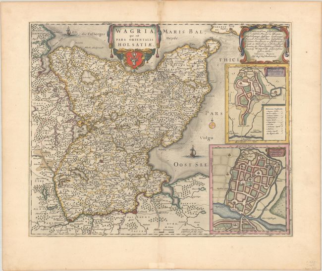
This map focuses on the eastern portion of Schlewsig-Holstein and is attributed to Matthias and Nicolaus Peters Goltschmide. The map includes the fortified city of Lubeck and dozens of tiny towns, with early roads shown between cities. At right are two maps of Oldenburg, showing the changes in the city beteen 1320 and 1651. The map is adorned with two strapwork cartouches, a small compass rose, and two galleons. Engraved by Hus. Spanish text on verso, published between 1659-72.
References: Van der Krogt (Vol. II) #1670:2.2.
Condition: A
A crisp impression with full contemporary color on a sheet with a large watermark of the god Atlas. There are a couple of minute worm holes, minor toning along the centerfold at top, and an old paper repair on recto along the bottom centerfold.