Subject: Portugal & Western Spain
Period: 1794 (dated)
Publication: A New Universal Atlas
Color: Hand Color
Size:
16.1 x 22.8 inches
40.9 x 57.9 cm
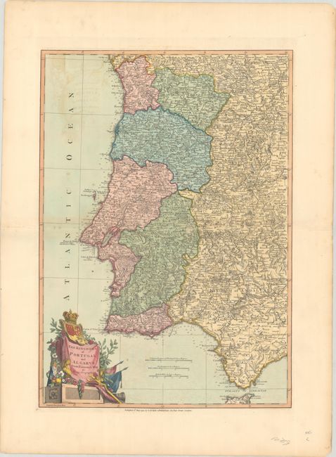
An uncommon and well engraved chart that details the coast from Marbella, through Gibraltar and up the Portuguese coast to Bayona, Spain. Excellent details with scores of villages and towns, roads, plus much topographical information. The large, decorative cartouche features the coat-of-arms, flags, flowers and Christ on the crucifix. Engraved by John Lodge and based on a two-sheet map by Giovanni Antonio Rizzi-Zannoni, Mapa dos Reynos de Portugal e Algarve….
References: Shirley (BL Atlases) T.LAU-1a #20.
Condition: B+
A sharp impression with full contemporary color on a bright sheet with a "J. Whatman 1804" watermark. There is light offsetting, a few small spots, and archival repairs to several separations along the centerfold. There are some short tears along the edges of the sheet, well away from the image.