Subject: Northern France
Period: 1602 (published)
Publication: Theatrum Orbis Terrarum
Color: Hand Color
Size:
18.4 x 13.4 inches
46.7 x 34 cm
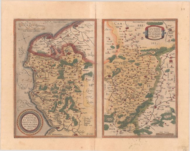
Two maps on a folio sheet. Calentensium covers the coastline between Calais and Estaples in very good detail, based in part on a four-sheet map by Nicolas de Nicolay. Veromanduorum covers a small region surrounding Saint-Quentin in northern France. The cartographical source of the map was Jean de Surhon who received royal privilege to make a map of the region in 1557. Each is covered with tiny forests and cities and has a decorative title cartouche. Spanish text on verso, published in 1598, the first year the right-hand map appeared on this sheet. Prior to 1598, the map of Veromanduorum was depicted with south at the top.
References: Van den Broecke #45.
Condition: B+
A dark impression with full contemporary color on a sheet with the horn coat of arms watermark commonly found on Ortelius maps. There is very light toning and some small stains in the image, primarily at left.