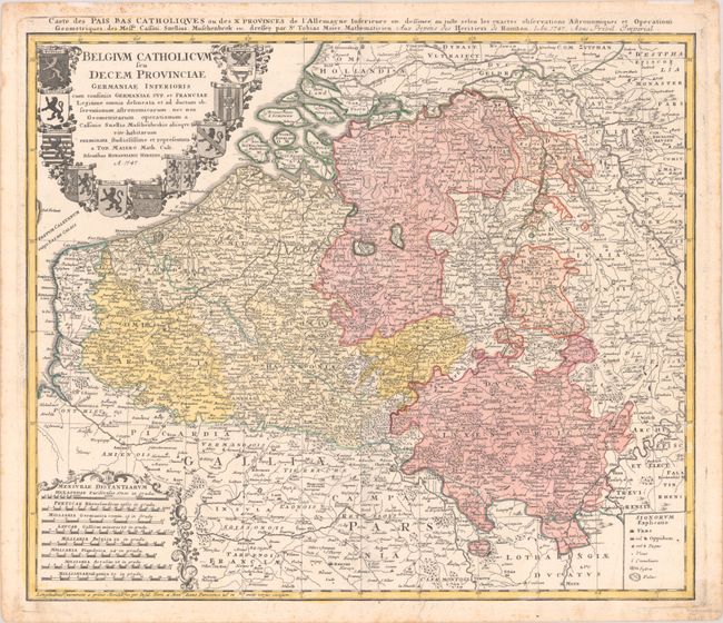
Subject: Belgium & Luxembourg
Period: 1747 (dated)
Publication:
Color: Hand Color
Size:
22.3 x 18.9 inches
56.6 x 48 cm
This attractive copper engraved map is filled with detail of even the tiniest villages. It includes Luxembourg and the bordering regions of France and Germany. The top left corner is adorned with a large decorative title cartouche surrounded by coats of arms. Another cartouche at bottom left wreathes the eight distance scales in garlands. The key at bottom right identifies cities, towns, villages, abbeys, forests, and swamps. An alternate French title runs above the upper neatline: "Carte des Pais Bas Catholiques ou des X Provinces de l'Allemagne Inferieure etc."
References:
Condition: A
A nice impression with full contemporary color on a bright sheet with marginal foxing and a tear that enters 1 cm into the image at bottom that has been closed on verso with old paper.