Subject: Cartographic Miscellany, Mountains & Rivers
Period: 1860 (circa)
Publication: Johnson's New Illustrated Family Atlas...
Color: Hand Color
Size:
23.8 x 16.8 inches
60.5 x 42.7 cm
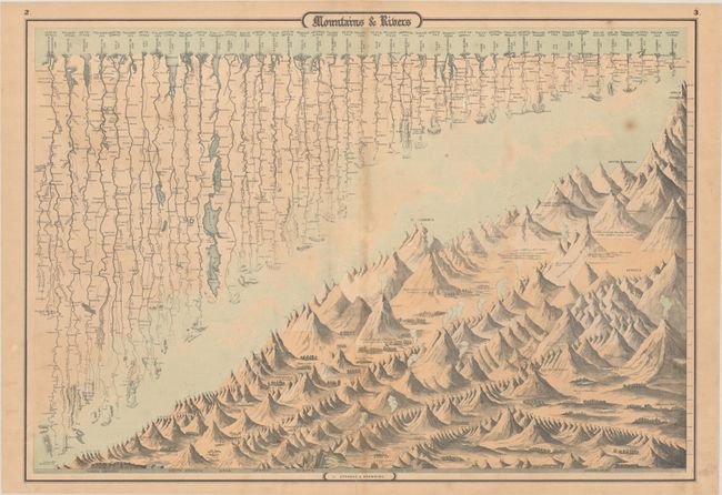
J.H. Colton first issued this great double-page chart showing the major rivers and mountains of the world in 1855. The map is divided diagonally in an interesting composition. In the upper portion, scores of rivers are named and drawn to indicate their relative lengths. The lower half of the sheet features stylized renderings of the mountains organized by continent and drawn to indicate their relative heights. Volcanoes are shown erupting and major cities are shown at their respective elevations.
References:
Condition: B+
There is light toning that is more prominent along the centerfold, minor foxing, and short archivally repaired centerfold separations in the top and bottom margins.