Subject: Eastern Belgium
Period: 1640 (circa)
Publication: Theatrum Orbis Terrarum
Color: Hand Color
Size:
19.8 x 15 inches
50.3 x 38.1 cm
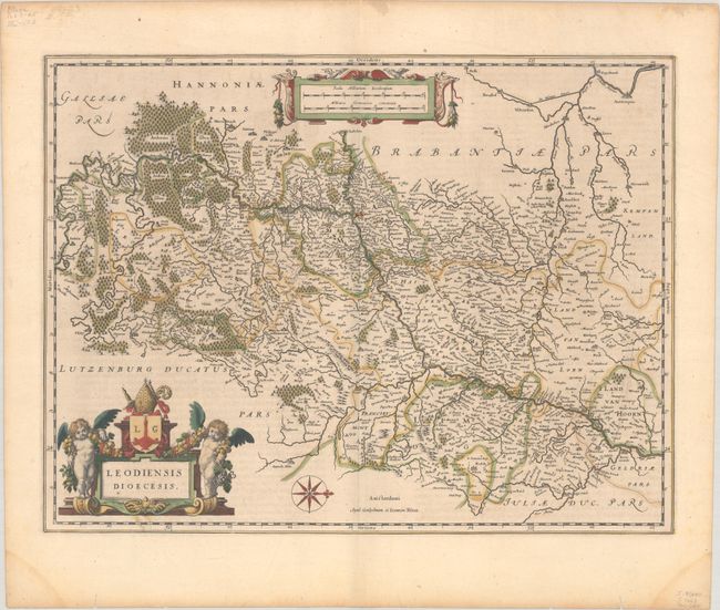
This elegantly engraved map covers the Meuse River valley, spanning from the southern tip of Gelderland south to Douzy in northern France. Several towns and cities are named, including Maastricht, Liege, Namur, and Dinant, and the Ardennes Forest is depicted as a vast cluster of trees in the top left corner. There is an ornate distance scale cartouche at top, and an elaborate title cartouche at bottom left with two putti and a coat of arms. A compass rose orients north to the right. Latin text on verso, published between 1640-55.
References: Van der Krogt (Vol. II) #3360:2
Condition: A
A crisp impression with full contemporary color on a watermarked sheet with several worm tracks and damp stains in the far blank margins.