Subject: Baltic, Latvia & Estonia
Period: 1741 (circa)
Publication:
Color: Hand Color
Size:
23 x 19.3 inches
58.4 x 49 cm
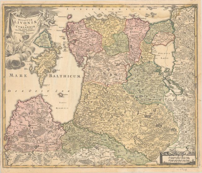
This attractive map of Estonia and Latvia shows the fortified towns of Riga, Goldingen (Kuldiga), Pernow (Parnu), Hapsal (Haapsalu), Derpt (Tartu), and Narva and is filled with hundreds of tiny villages, forests, marshes, mountains, and rivers. The islands of Oesel (Saaremaa) and Dagho (Hiiumaa) are prominent in the Gulf of Riga. The sheet is decorated with a drape-style title cartouche held aloft by weapon-wielding putti and a scale cartouche in the opposite corner.
References:
Condition: B+
A crisp impression with full contemporary color on a sheet with an Elias Kutter watermark. There is light dampstaining that enters the edges of map image, most apparent at top right. There is an old paper repair in the bottom left blank margin.