Subject: Scandinavia
Period: 1729 (published)
Publication: Introductionis in Universam Geographiam
Color: Hand Color
Size:
10.2 x 8.3 inches
25.9 x 21.1 cm
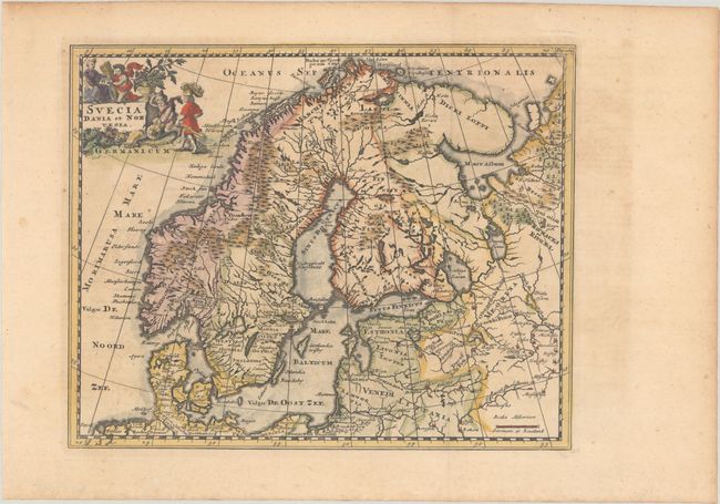
This handsome small map shows the historical regions in Scandinavia and the Baltic. The map is finely engraved to show the topography, forests and locates ancient cities. It is adorned with a decorative landscape cartouche featuring cherubs busily at work.
Cluver's Introductio in Universam Geographicam was a popular atlas, appearing in over 45 editions during a 100-year period. The first edition was published without maps in the 1620s, and the first edition to include maps was published circa 1641. The various editions were published in different cities throughout Europe, including Amsterdam, Nuremberg, and London. This map is from an Amsterdam edition, edited by Bruzen de la Martiniere with maps by Jan Wolters and four newly engraved maps after Delisle.
References: Shirley (BL Atlases) T.CLUV-8b.
Condition: A
A dark impression, issued folding on a sheet with a hint of toning and offsetting.