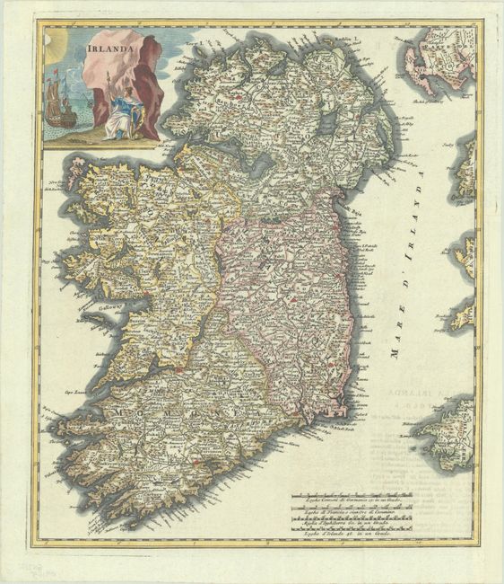
Subject: Ireland
Period: 1743 (circa)
Publication: Lo Stato Presente... E Dell’Irlanda
Color: Hand Color
Size:
12.7 x 14.8 inches
32.3 x 37.6 cm
This Italian map is based on the cartography of Delisle and includes a great deal of information on the towns, villages and roads. The map was made just after one of the great Irish famines (1740-41) known commonly as the bliain an áir (year of the slaughter) and the Great Frost. The title cartouche reflects this bleak period with ships in a stormy sea and the figure of Hibernia set against a frozen background.
References:
Condition: A
A sharp impression, issued folding on a bright sheet with light offsetting from an opposing page of text at bottom right, and a binding trim in the right margin that has been professionally replaced with paper. Remnants of hinge tape on verso.