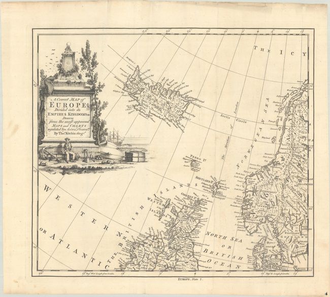
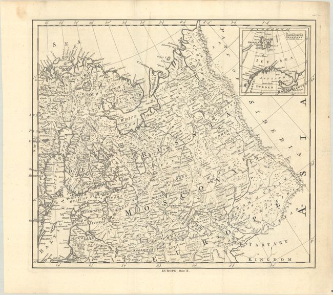
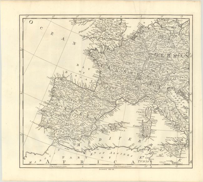
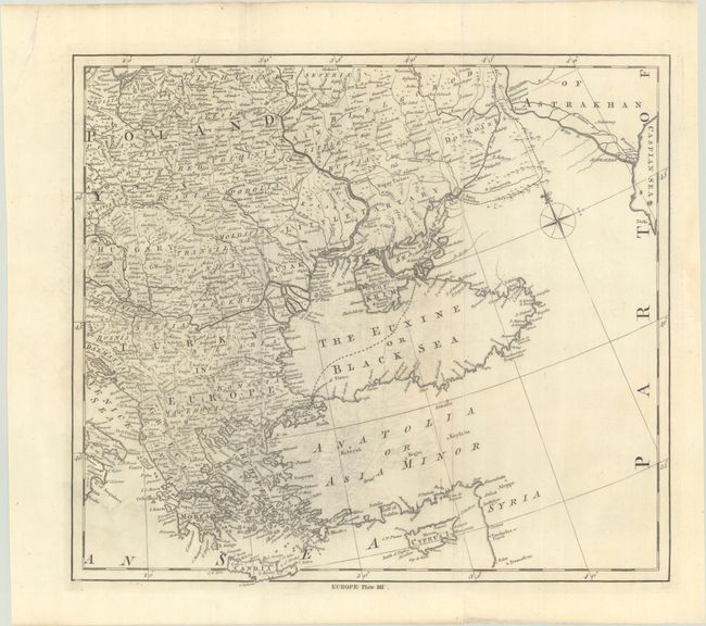
Subject: Europe
Period: 1755 (circa)
Publication: The Universal Dictionary of Trade and Commerce
Color: Black & White
Size:
15.7 x 13.9 inches
39.9 x 35.3 cm
This four-sheet map was published in Malachy Postlethwayt's The Universal Dictionary of Trade and Commerce. Kitchin borrowed extensively from the work of d'Anville, Robert de Vaugondy, and other eminent geographers of his time to produce this detailed map of Europe. It shows numerous place names, political boundaries, lakes and rivers, mountains, and more. Adorned by a decorative cartouche in the first plate illustrating a seaman with an anchor, maritime paraphernalia, and a ship in the background. Each sheet has its own borders and were not intended to be joined. Dimensions vary slightly from sheet to sheet.
References:
Condition:
Crisp impressions on bright sheets of watermarked paper. There is some light creasing, a few faint spots, and light offsetting on plate 4. (Plates 2/3 - A condition, Plates 1/4 - B+ condition). The first image is a composite image - the map is in 4 separate sheets.