Subject: Europe
Period: 1651 (published)
Publication: Carte Generalle de la Geographie Royalle
Color: Hand Color
Size:
7.7 x 5.9 inches
19.6 x 15 cm
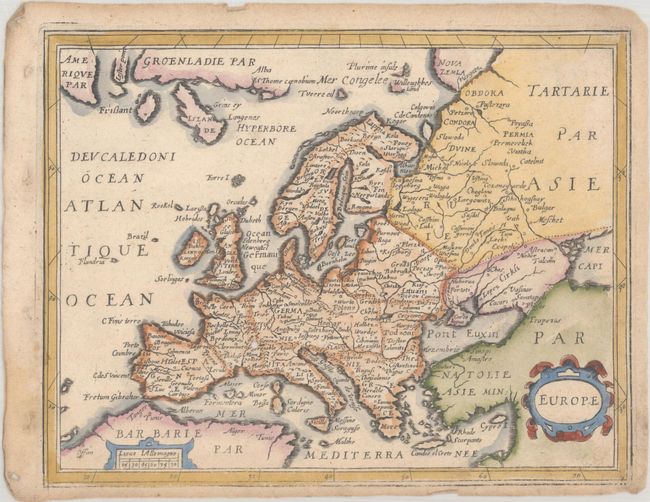
This uncommon small map of the continent includes the mythical island of Frislant to the west of Iceland. It also depicts the small, apocryphal island of Brazil in the Atlantic. The tiny island of Rookol (Rockall) is located as well. Nova Zemla is a vaguely defined stretch of coast in the north, with nearby coastlines labeled Plurime Insule and Willoughbes Land. The latter refers to Hugh Willoughby, an English explorer who searched for a Northeast passage to the East Indies in 1553. The map names several towns and cities and delineates rivers. There is a strapwork title cartouche at bottom right and a small distance scale cartouche at bottom left. According to Pastoureau, the map was likely engraved by H. Picart.
Although the atlas, Carte Generalle de la Geographie Royalle, is typically attributed to Christophe Tassin, the atlas wasn't published until 1651, several years after Tassin had ended his commercial activity and sold his plates to Nicolas Berey and Antoine de Fer.
References: Pastoureau, TASSIN I A [2].
Condition: B+
A nice impression that is a bit faint in the bottom border. There is a small worm hole near Geneva, very light soiling, and light toning along the edges of the sheet.