Catalog Archive
Auction 204, Lot 320
"A Map of Old Greenland of Oster Bygd & Wester Bygd... [on sheet with] A Map of the Islands of Ferro or Farro... [and] A Draught of the Whirlpool on the South East of Sumbo Rocks...... [and] An Improved Map of Iceland", Bowen, Emanuel
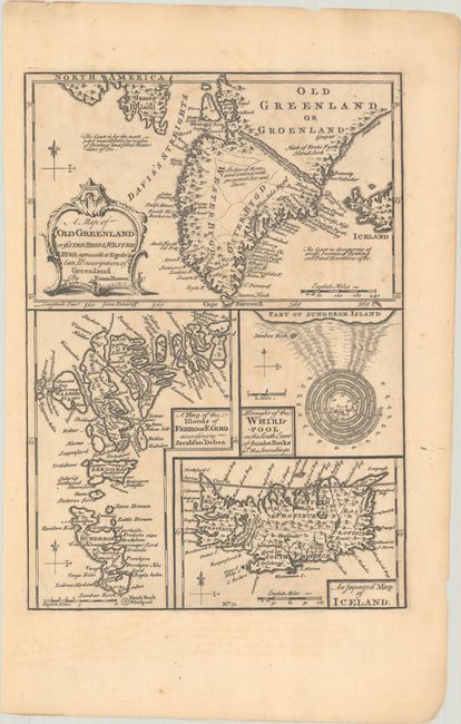
Subject: North Atlantic
Period: 1747 (circa)
Publication: A Complete System of Geography
Color: Black & White
Size:
9 x 12.8 inches
22.9 x 32.5 cm
Download High Resolution Image
(or just click on image to launch the Zoom viewer)
(or just click on image to launch the Zoom viewer)