Subject: Atlantic Islands
Period: 1644 (circa)
Publication: De Rebus Publicis Hanseaticis
Color: Hand Color
Size:
13.9 x 10.3 inches
35.3 x 26.2 cm
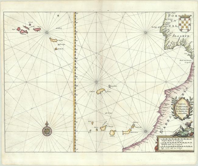
This rare chart focuses on the Azores, Madeira, and Canary Islands in the eastern Atlantic Ocean. The map includes the coastline of Portugal and northwestern Africa, and the coat of arms of Portugal is depicted within the interior. Decorated with a compass rose, rhumb lines, and a decorative title cartouche. Engraved by Merian and published in Johann Angel von Werdenhagen’s De Rebus Publicis Hanseaticis.
References: Shirley (BL Atlases) G.Werd-1a #145.
Condition: B+
A sharp impression on a bright sheet with the watermark of a crowned coat of arms with a crozier. There is a small hole along the centerfold that has been closed on verso with a minor amount of a rhumb line replaced in facsimile.