Subject: Peru
Period: 1638 (published)
Publication: Atlas Novus
Color: Hand Color
Size:
19.3 x 14.9 inches
49 x 37.8 cm
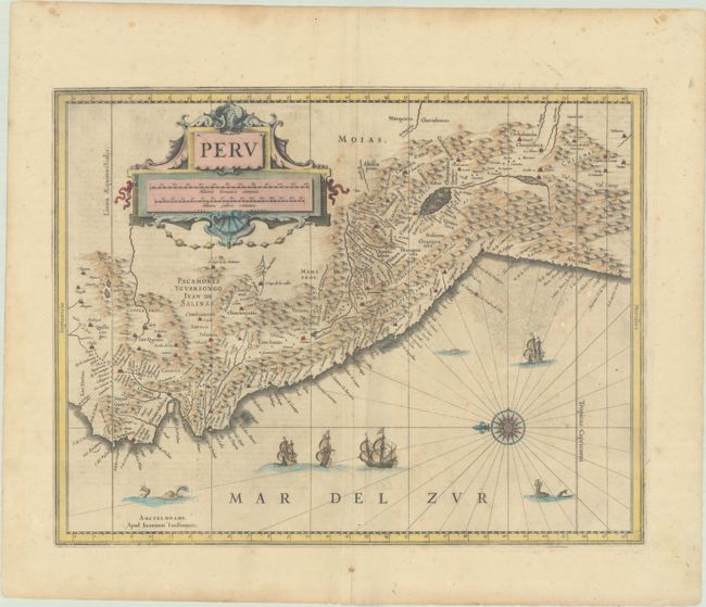
A large compass rose orients north to the left on this map of the Empire of Peru. It covers the Pacific coast of South America from Ecuador as far south as the Atacama Desert in the northern reaches of Chile. It includes the Potosi silver mines, Titicaca, Cusco, Quito, and numerous other towns and villages. The large cartouche incorporates both the title and the distance scales and is decorated with sea shells. The sheet is further decorated with four Spanish galleons and three sea monsters. This map is one of the many similar maps that were produced by both Jansson and Blaeu. Latin text on verso.
References: Van der Krogt (Vol. I) #9820:1.
Condition: B+
There is light soiling and foxing, as well as a couple of extraneous creases adjacent to the centerfold. A centerfold separation in the bottom margin and another near the center of the image have been archivally repaired.