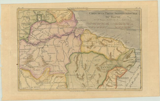
Subject: Northern Brazil
Period: 1780 (circa)
Publication: Atlas de Toutes les Parties Connues du Globe Terrestre
Color: Hand Color
Size:
12.5 x 8.4 inches
31.8 x 21.3 cm
This map covers northern Brazil, from Cayenne to just past Salvador. There is good detail of the rivers in the region, particularly the Amazon River, and a remnant of L. Parime appears in Guinea. The direction of trade winds are shown in the Atlantic.
Rigobert Bonne was an important French cartographer of the late 18th century. In 1773 he succeeded Jacques Bellin as the royal cartographer in the office of the Hydrographer at the Depot de la Marine. Working in his official capacity, Bonne compiled some of the most detailed and accurate maps of the period.
References:
Condition: B+
A crisp impression with very light toning, a few tiny spots of foxing, and a paper flaw in the left margin.