Subject: South America
Period: 1748 (dated)
Publication:
Color: Hand Color
Size:
30.4 x 15.4 inches
77.2 x 39.1 cm
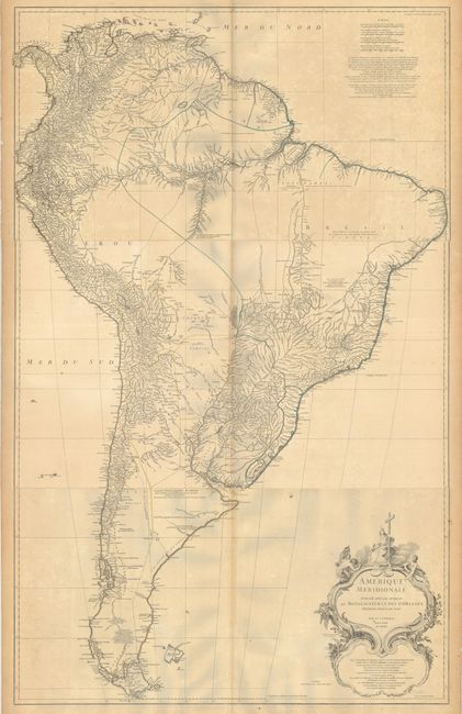
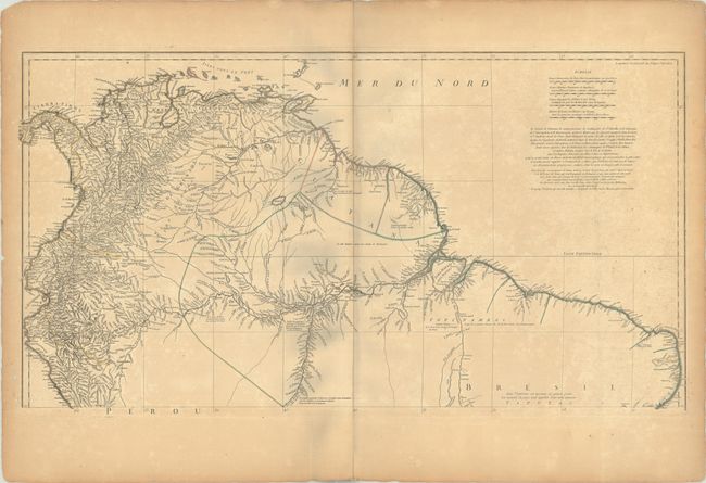
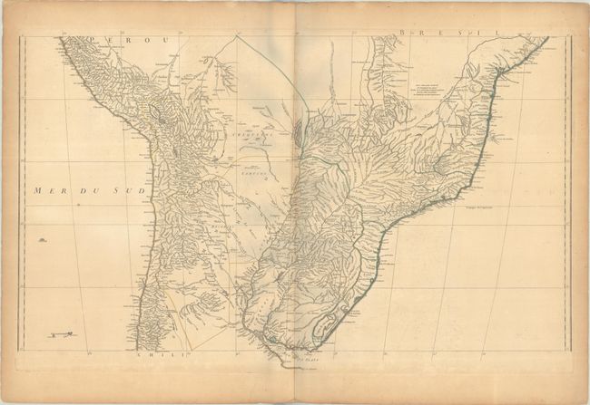
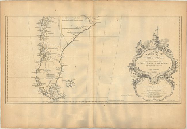
This huge map is printed on three sheets and presents towns and villages, river systems, topography and much detail along the coastline. However, areas of the interior are left blank by d'Anville where geographical knowledge was scare or nonexistent. Short notations are included throughout the map, and two mythical lakes still appear: Parima L. in Guyana and Laguna de los Xareyes in the center of the continent. A large rococo-style cartouche in the lower right corner includes notes on the creation of the map. Engraved by Delahaye. Sheet size varies slightly. If the sheets were joined together, the map would measure approximately 30 x 45".
References: Rumsey #73.
Condition: B
Contemporary outline color on sturdy watermarked paper with light to moderate toning and minor foxing. The northern sheet has a few small wormholes in the left blank margin. The grayish hue adjacent to the centerfolds is caused by our scanner and is not present on the physical maps (this effect is more pronounced on the southern sheet). The first image is a composite image - the map is in 3 separate sheets.