Current Auction
Lot 284
Current Auction

"Carte des Isles Antilles ou du Vent avec la Partie Orientale des Isles sous le Vent", Bonne, Rigobert

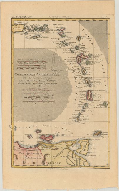
Subject: Lesser Antilles

Period: 1780 (circa)

Publication: Atlas de Toutes les Parties Connues du Globe Terrestre

Color: Hand Color

Size:
8.6 x 12.7 inches
21.8 x 32.3 cm
Download High Resolution Image
(or just click on image to launch the Zoom viewer)

This well engraved copperplate chart details the Windward Islands and the eastern Leeward Islands. It extends to include about half of Puerto Rico, the northern portion of Venezuela, and all of Trinidad. There are seven different distance scales.

Rigobert Bonne was an important French cartographer of the late 18th century. In 1773 he succeeded Jacques Bellin as the royal cartographer in the office of the Hydrographer at the Depot de la Marine. Working in his official capacity, Bonne compiled some of the most detailed and accurate maps of the period.

References:

Condition: B+

A crisp impression on a sturdy sheet with light toning.

Estimate: $110 - $140

Current High Bid:
$80

Reserve: Reserve Met
Next Bid: $85

Bid Increments
$50 - $99$5
$100 - $249$10
$250 - $499$25
$500 - $999$50
Terms & Conditions