Subject: Jamaica
Period: 1780 (circa)
Publication: Atlas de Toutes les Parties Connues du Globe Terrestre
Color: Hand Color
Size:
12.5 x 8.3 inches
31.8 x 21.1 cm
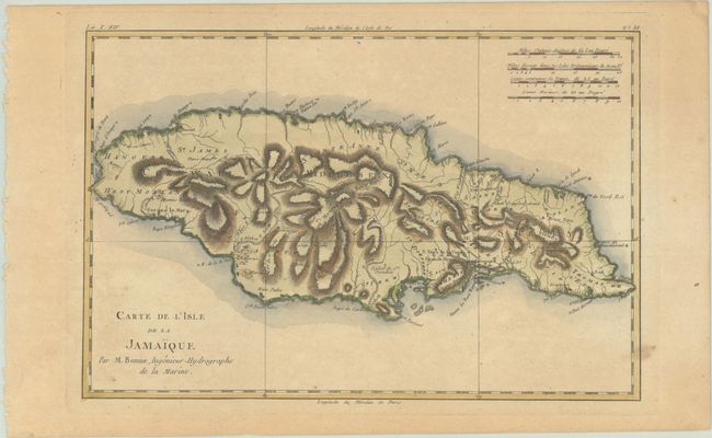
An attractive, engraved map of Jamaica with great topographical detail and locations of settlements, ports, and forts. The Blue Mountains, Montego Bay, and Kingston (here called Kingstown) are noted as well as many other places of interest. Includes four distance scales at upper right.
Rigobert Bonne was an important French cartographer of the late 18th century. In 1773 he succeeded Jacques Bellin as the royal cartographer in the office of the Hydrographer at the Depot de la Marine. Working in his official capacity, Bonne compiled some of the most detailed and accurate maps of the period.
References:
Condition: B+
A crisp impression with light toning and a few spots of foxing.