Current Auction
Lot 275
Current Auction

"Geographical, Statistical, and Historical Map of the West Indies", Carey & Lea
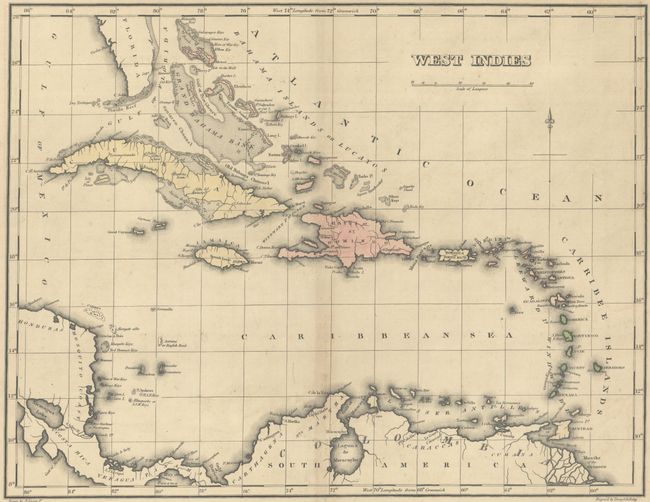
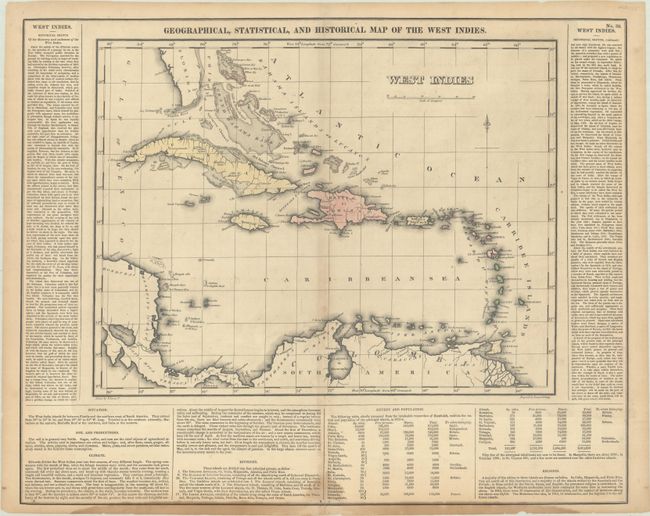
Subject: Caribbean

Period: 1827 (circa)

Publication: A Complete Historical, Chronological, and Geographical American Atlas...

Color: Hand Color

Size:
15.9 x 12.2 inches
40.4 x 31 cm
Download High Resolution Image
(or just click on image to launch the Zoom viewer)

An attractive map of the islands surrounded by text describing the history of the region and the voyages there by Christopher Columbus. Detail is mainly along the coastlines with place names, banks, reefs and shoals identified. The panels of text further describe climate, island groups, population and religious affiliations. Engraved by Young & Delleker. On a full sheet with English text measuring 22.1 x 17.5".

References:

Condition: B

Contemporary color with a hint of toning along the centerfold and some dampstaining along the bottom border mostly in the blank margin. There are short archivally repaired fold separations at top and bottom as well as a few short repaired edge tears.

Estimate: $140 - $170

Current High Bid:
$0

Reserve: Reserve Not Met
Next Bid: $70

Bid Increments
$50 - $99$5
$100 - $249$10
$250 - $499$25
$500 - $999$50
Terms & Conditions