Subject: Veracruz, Mexico
Period: 1798 (dated)
Publication:
Color: Black & White
Size:
22.9 x 17.4 inches
58.2 x 44.2 cm
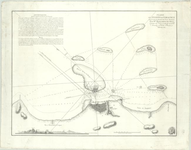
This uncommon chart covers Veracruz and its approaches. It is the first printed hydrographic survey of the region, based on the surveys of (and prepared under the direction of) Bernardo de Orta, the captain of the Royal Armada stationed in Veracruz. The city of Veracruz and its fortifications are depicted in plan form, with a plan of San Juan de Ulua, the fortified complex, appearing across the water. Soundings, hazards, various nearby isles, and other navigational information is provided. A view of the rocky, jagged coastline runs across the bottom left corner, and there are extensive navigational notes in the top left corner. The emblem for Deposito Hidrografico is in the bottom right corner. Prepared by Felipe Bauza and engraved by Fernando Selma.
References:
Condition: B+
A sharp impression on a watermarked sheet that has been professionally backed with archival tissue. There are some small faint dampstains at left and right, a tiny hole in the Deposito Hidrografico emblem, and light soiling that is mostly confined to the blank margins. A chip in the top left corner of the map image has been repaired with archival materials, as have a chip in the top right blank margin and two short edge tears also in the right margin.