Catalog Archive
Auction 204, Lot 250
"Yellowstone National Park and Part of Abutting Forest Reserve from Maps by the U.S. Geological Survey", U.S. Geological Survey (USGS)
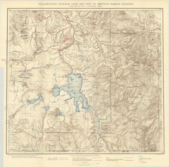
Subject: Yellowstone, Wyoming
Period: 1904 (circa)
Publication:
Color: Printed Color
Size:
19.9 x 18 inches
50.5 x 45.7 cm
Download High Resolution Image
(or just click on image to launch the Zoom viewer)
(or just click on image to launch the Zoom viewer)