Subject: Washington
Period: 1949 (dated)
Publication:
Color: Printed Color
Size:
34 x 21.1 inches
86.4 x 53.6 cm
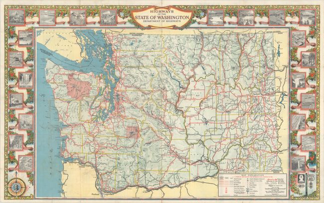
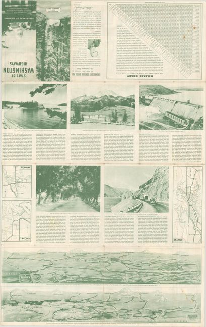
This uncommon highway map of Washington was prepared by Rand McNally & Co. and lithographed by the Seattle-based North Pacific Bank Note Company. It is distinguished by its fine decorative border which incorporates 22 black & white illustrations of sites around the state, including Olympic National Park, the state capitol building, Columbia Gorge, Mount Rainier, and Grand Coulee Dam. The state seal appears in the center of a compass rose at bottom left. A key in the map identifies various roads, railroads, airports, bridges, ferries and boatlines, county seats, and more. Self-folds into a brochure with the title "State of Washington Highways." The verso features small maps of Seattle, Spokane, and Tacoma and two panoramic views.
References: cf. Rumsey #9783.
Condition: B+
Issued folding with light wear along the fold lines and minor soiling at lower left. There are a number of short splits at the fold junctions with minute loss of image.