Subject: Texas
Period: 1860 (dated)
Publication:
Color: Hand Color
Size:
13.5 x 10.8 inches
34.3 x 27.4 cm
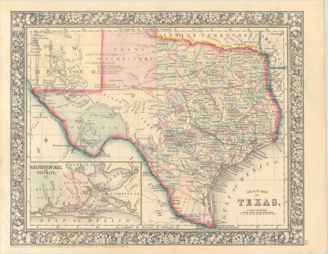
One of the most attractive maps of the state of Texas, inset with a map of Galveston Bay, and Vicinity. West Texas is made up of Young Territory, Bexar Territory, El Paso, and Presidio counties, and clearly shows the Llano Estacado or Staked Plain with a notation about the region being "destitu[t]e of both wood and water." Erath County is mistakenly identified as "Earth" County. The map shows trails, roads, a limited railroad system that extends only into Austin, and proposed railroads indicated by dashed lines. The map is surrounded by a fine floral border. Copyright date 1860, published circa 1864. County development is up-to-date for 1864 as Dawson County, abolished in 1866, is included.
References:
Condition: A
Contemporary color with faint dampstaining in the left margin.