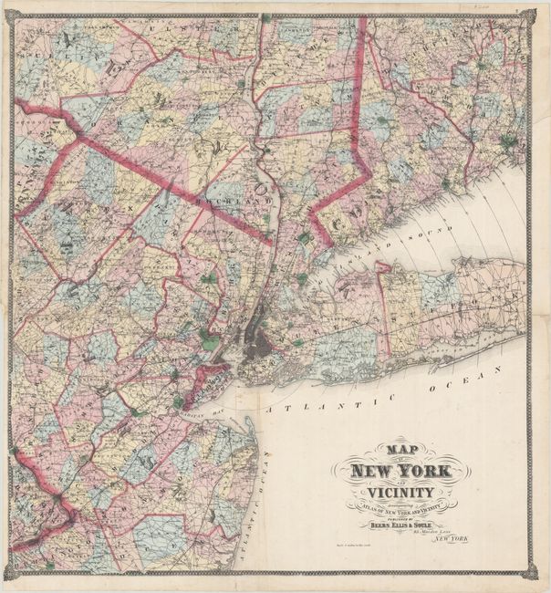
Subject: Southeastern New York & Northern New Jersey
Period: 1867 (circa)
Publication: Atlas of New York and Vicinity from Actual Surveys
Color: Hand Color
Size:
28.4 x 30.4 inches
72.1 x 77.2 cm
This uncommon and colorful large-format map was published only once in this atlas. It depicts the portion of New York State south of Poughkeepsie and the western half of Long Island. It also presents half of Connecticut west from New Haven, the northern half of New Jersey including Trenton and a small portion of Pennsylvania. The map presents remarkable detail of towns and villages, roads, railroads, and political boundaries including counties and townships. Cities and larger towns are drawn in street grid format and even Central Park is named. Circles at five mile increments radiate from lower Manhattan. The map is embellished with fancy titling and flourishes, and surrounded by a decorative border.
References:
Condition: B
Issued folding on a bright sheet with vibrant contemporary color. There are professional repairs to several small separations along the horizontal fold and to a long tear in the upper third of the image. There is some minor image loss in northern Manhattan and Mount Pleasant township along the Hudson River.