Subject: Washington, D.C.
Period: 1891 (circa)
Publication:
Color: Printed Color
Size:
13.1 x 16.3 inches
33.3 x 41.4 cm
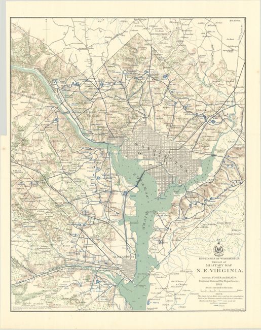
This historical and interesting map details the various defenses poised to defend Washington from the Confederate Army during the Civil War. Beautifully engraved, the map extends to include Alexandria, Falls Church, Silver Spring, and Bladensburg. With remarkable detail, the map locates forts in blue, schools, mills, railroads, fortifications, and more. There are scores of individual homes and farms located with the owner's name. Washington is shown in street-grid plan format. Fine detail of watershed and topography. The map was published to accompany the "report of Brig. Gen. Richard Delafield…dated October 30, 1865." Another note "See Atlas, Plates VII. And VIII." apparently refers to the larger-scale maps in the Civil War atlas. Dated 1865, but published 1891-95. Printed by Julius Bien & Co. Lith., N.Y.
References:
Condition: A
Issued folding on a clean bright sheet with a binder's trim at upper left.