Subject: World
Period: 1748 (dated)
Publication:
Color: Hand Color
Size:
27.8 x 20 inches
70.6 x 50.8 cm
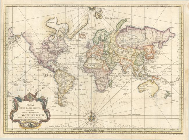
This very large and attractive world chart is drawn on Mercator's projection. North America is shown with a prominent River of the West connecting through a series of rivers and lakes from Lake Superior to the Pacific - representing the elusive search for a Northwest Passage. The Russian discoveries in the North Pacific are shown with Alaska depicted as an island named I. Unamak. Australia is labeled Nouvelle Hollande with Terre de Diemen still linked to the mainland. New Zealand is fully formed showing both islands and is depicted twice -- both on the right and left-hand sides of the map. The large, decorative title cartouche and two fine compass roses with rhumb lines make this a very attractive chart. Australia and New Zealand reflect the discoveries of Capt. Cook, but Tasmania is still attached to Australia, suggesting a publish date after 1770.
References:
Condition: B+
A crisp impression, issued folding and now flattened on a sturdy sheet with a large watermark of a Maltese cross encircled in rosary beads. There is light soiling and professional repairs to some separations and small holes along the folds.