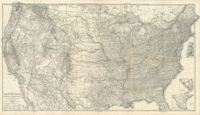
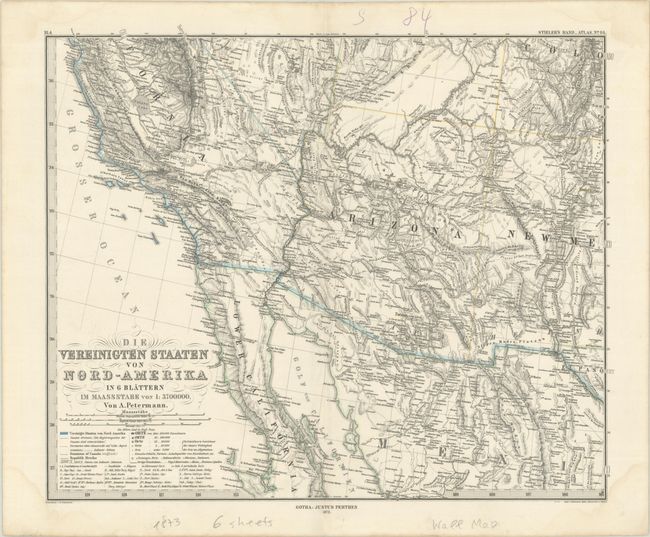
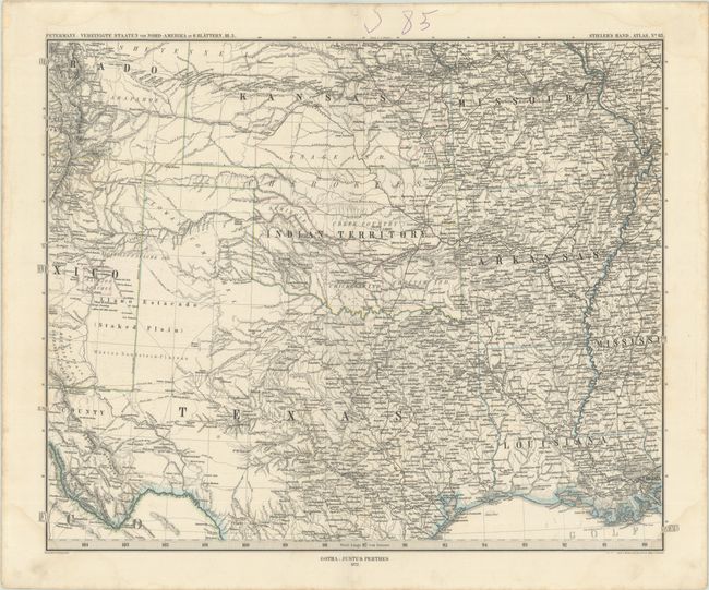
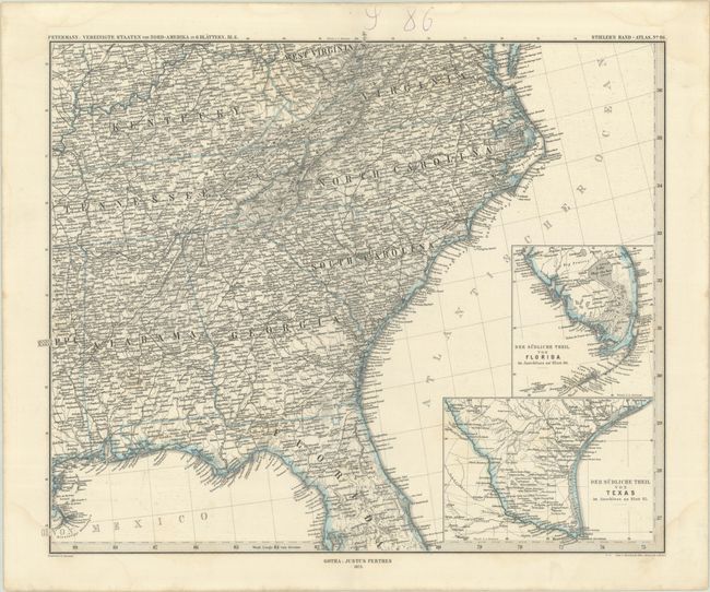
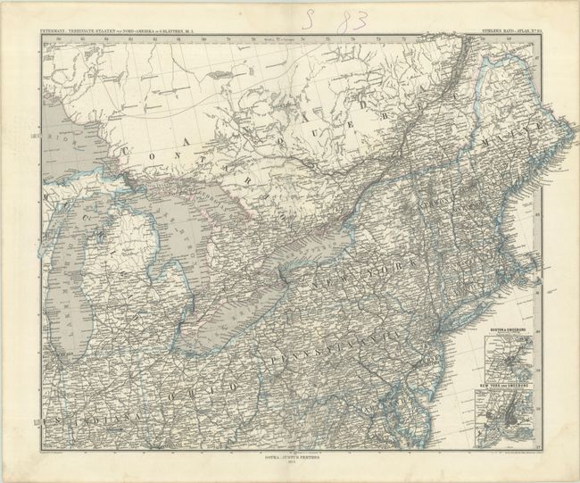
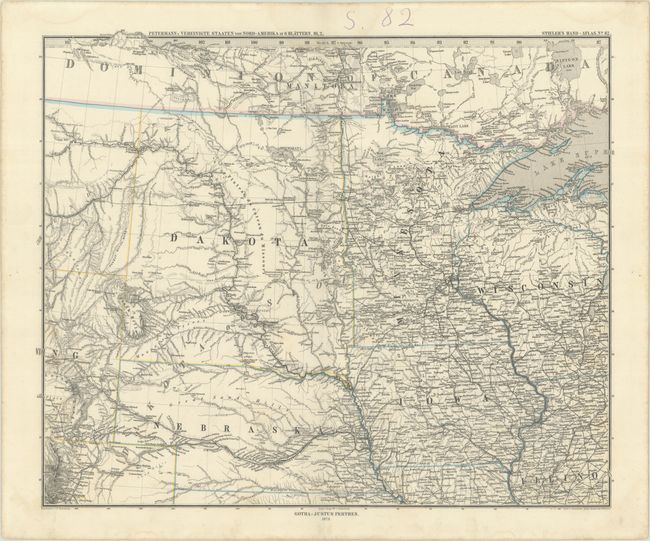
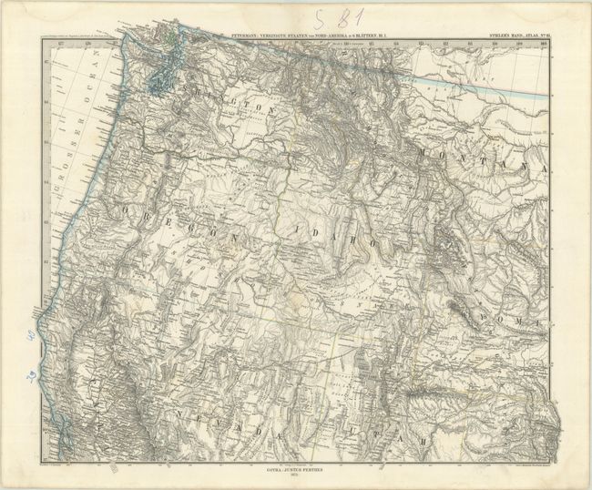
Subject: United States
Period: 1873 (dated)
Publication: Stieler's Hand-Atlas
Color: Hand Color
Size:
15.9 x 13.3 inches
40.4 x 33.8 cm
This remarkably detailed German map on six sheets was published by Justus Perthes for his Stieler's Hand-Atlas. It is filled with detail including place names, watershed, mountains delineated in hachure, Indian Reservations, railroads, trails, explorer's routes, and much more. Dakota is shown as a single large territory, and the newly created Yellowstone National Park is identified, having opened in the same year (1872) as the map's publication. Features insets of Boston, New York, southern Florida, and southern Texas. Surrounded by a keyboard-style border and fancy titling. If joined, the map would measure 39 x 32".
References:
Condition: B+
Crisp impressions with contemporary outline color on bright sheets. There are faint dampstains in the corners of each sheet, some of which just enter the map border. A previous owner has numbered the maps in ink in the top margin. The first image is a composite image - the map is in 6 separate sheets.