Catalog Archive
Auction 203, Lot 696

NO RESERVE

"Carte des Royaumes de Congo, Angola, et Benguela, avec les Pays Voisins, Tire de l'Anglois", Bellin, Jacques Nicolas

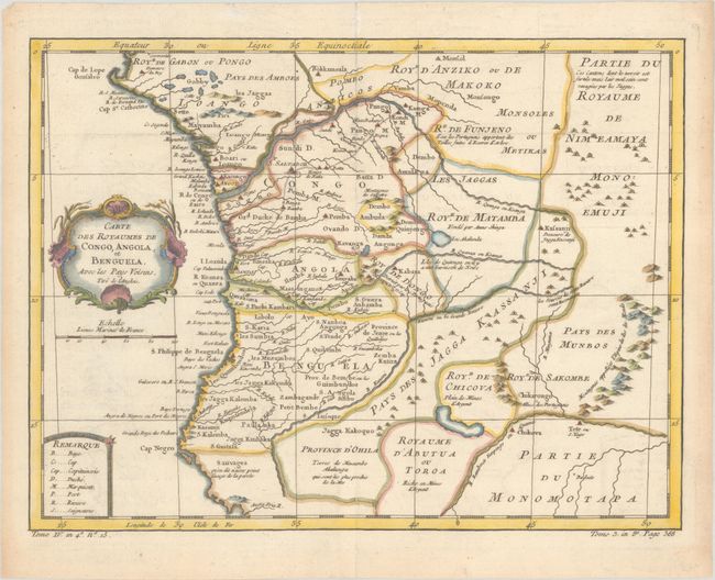
Subject: Western Africa

Period: 1760 (circa)

Publication: Histoire Generale des Voyages

Color: Hand Color

Size:
12.4 x 9.4 inches
31.5 x 23.9 cm
Download High Resolution Image
(or just click on image to launch the Zoom viewer)

This elegantly engraved and nicely detailed map shows present-day Gabon, Congo, and Angola. Several towns and cities are named, contemporary political divisions are delineated, and several rivers are traced. A road spans from Luanda to Kamga M on the Congo River. Notes in French text indicate speechless tribes, an area destroyed by the Portuguese, silver mines, and more. A key at bottom left identifies abbreviations used in the map. The title is contained in an ornate cartouche.

References:

Condition: A

A nice impression issued folding, now flat, on watermarked paper. There is minor offsetting and marginal toning.

Estimate: $100 - $130

Sold for: $75

Closed on 4/23/2025

Archived