Subject: Colonial North America
Period: 1741 (circa)
Publication:
Color: Black & White
Size:
7.2 x 5.9 inches
18.3 x 15 cm
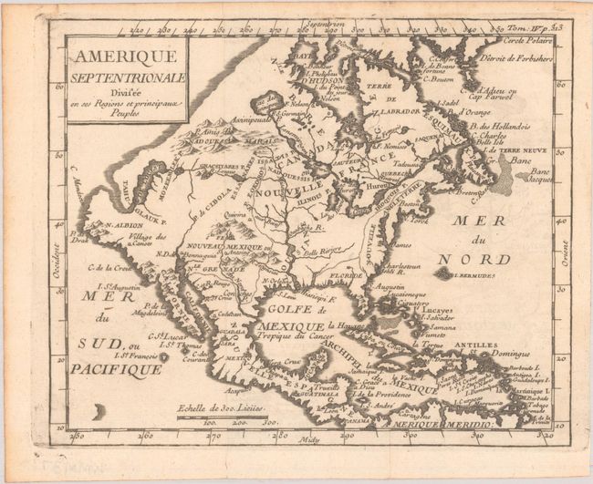
This fascinating small map appeared in several geography books by Nicolas Lenglet-Dufresnoy in the mid-18th century. It presents an unusual configuration for the northwest coast of North America, running diagonally from California to Husdon Bay. The Sea of the West connects to a river flowing east, nearly intersecting with a remnant of Lanhotan's R. Longue. New England is confined to the eastern seaboard, where only a few place names are noted, including Boston, New York, Jamestown and Charleston. An interesting and uncommon map.
References: McGuirk #12.
Condition: A
A nice impression, issued folding on a watermarked sheet with a hint of offsetting and a tiny fold separation in the bottom margin.