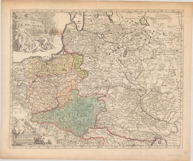
Subject: Eastern Europe, Poland
Period: 1792 (circa)
Publication:
Color: Hand Color
Size:
23.9 x 19.1 inches
60.7 x 48.5 cm
This large map covers Poland, Lithuania, southern Latvia, Belarus, and part of Ukraine. It illustrates the Partitions of Poland when the entire territory of the Kingdom of Poland was divided between Prussia, Austria, and Russia. North of the Black Sea is an area labeled Dzike Polie ou Campagnes Desertes et Inhabitees - a deserted or uninhabited countryside. A network of roads connects the Tatars to Poland. The map is filled with detail and decorated with a title and scale cartouche flanked by mythological figures and putti.
References: Koeman, El 2 #18.
Condition: B
Contemporary color on a sheet with an elephant watermark and marginal toning. A 3" tear to the right of the title cartouche was previously closed with masking tape on verso, causing a tape stain; the masking tape has since been removed and replaced with archival tape.