Catalog Archive
Auction 203, Lot 543

"Pomeraniae, Wandalicae Regionis, Typ. [on sheet with] Livoniae Nova Descriptio, Joanne Portantio Auctore [and] Ducatus Oswieczensis, et Zatoriensis, Descriptio", Ortelius, Abraham

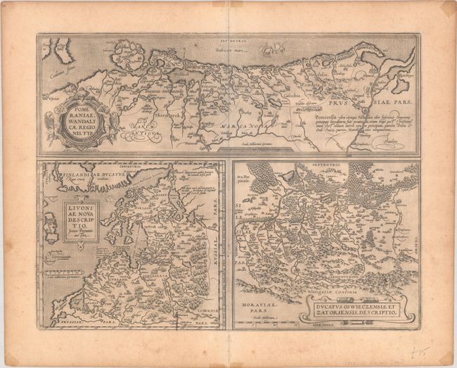
Subject: Eastern Europe & Baltic

Period: 1603 (published)

Publication: Theatrum Orbis Terrarum

Color: Black & White

Size:
19.6 x 15.2 inches
49.8 x 38.6 cm
Download High Resolution Image
(or just click on image to launch the Zoom viewer)

Three fine maps of the Baltic and Polish regions printed on a single folio sheet. The top map features Pomerania and is based on the Peter Artopaus map published in 1550 by Sebastian Munster. The map of Livonia was drawn by Johannes Portantius and is believed to have been based on the lost maps of the region by Marcus Ambrosius and Caspar Henneberger. The map of Oswieczensis was drawn by the Polish cartographer Stanislav Porebski in 1563. Latin text on verso.

References:

Condition: B+

A dark impression on a sturdy, lightly toned sheet with a small coat of arms watermark. There is some printer's ink residue, a couple small spots, and a small at top right caused by a paper flaw. Tape stains and light foxing are confined to the blank margins.

Estimate: $180 - $210

Sold for: $90

Closed on 4/23/2025

Archived