Subject: Central Europe, Germany
Period: 1772 (circa)
Publication:
Color: Hand Color
Size:
47.4 x 20.3 inches
120.4 x 51.6 cm
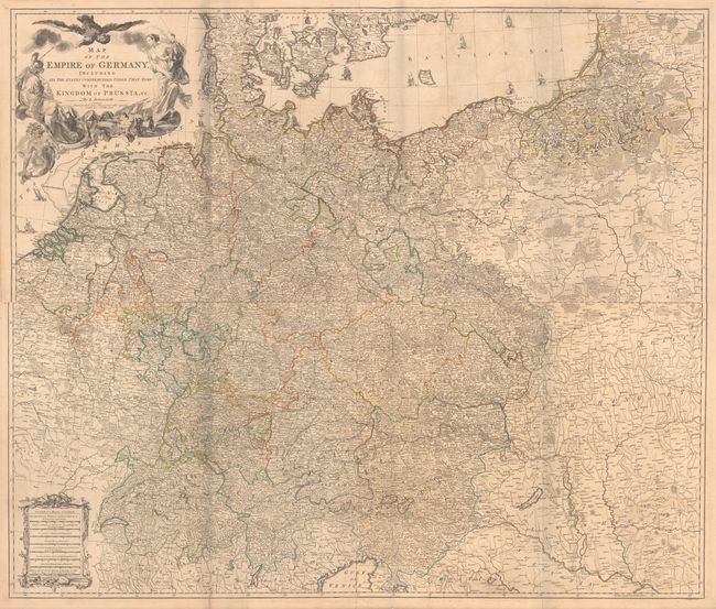
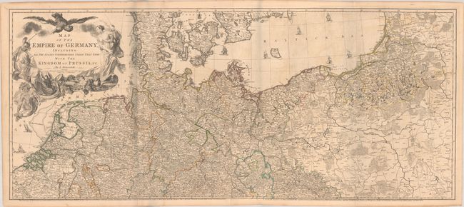
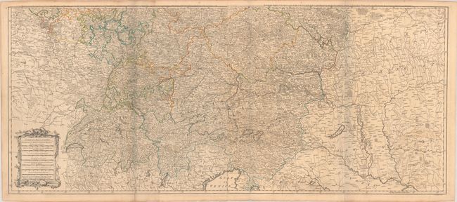
This large, well-detailed map covers the German Empire, which at the time extended from the Baltic Sea to the Gulf of Venice. It includes Germany, Austria, Czech Republic, Slovenia, Poland, Lithuania, Switzerland, the Netherlands, Belgium and most of Denmark. There is an extraordinary level of detail throughout, noting roadways, towns, castles, monasteries, forests, swamps, rivers, cities and mountains. An elaborate allegorical title cartouche in the upper left quadrant depicts the German double-headed eagle overlooking two warrior maidens who have just banished Medusa. Engraved by Thomas Kitchin and published by Robert Sayer. Printed on four sheets and joined as two horizontal sheets, as issued.
References:
Condition: B+
Contemporary outline color on watermarked paper with some light foxing and offsetting. The first image is a composite image - the map is joined in two horizontal sections.