Catalog Archive
Auction 203, Lot 415

"Nouvelle Carte de Scandinavie ou des Etats du Nord Dressee sur les Observations les Plus Nouvelles des Meilleurs Geographes avec les Armes des Provinces de la Suede et des Tables Tres Instructives", Chatelain, Henry Abraham

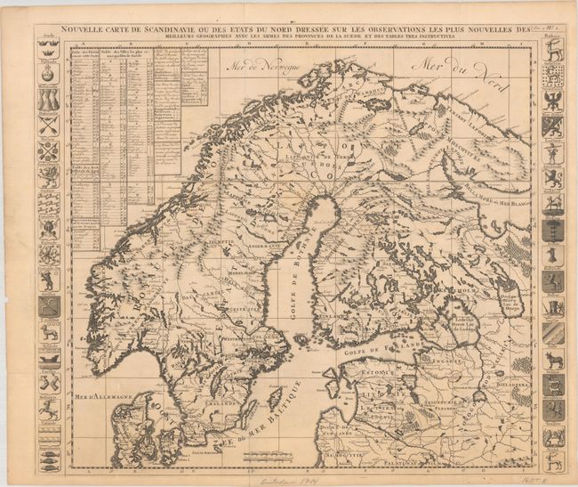
Subject: Scandinavia

Period: 1714 (circa)

Publication: Atlas Historique, Tome IV

Color: Black & White

Size:
23.4 x 19.8 inches
59.4 x 50.3 cm
Download High Resolution Image
(or just click on image to launch the Zoom viewer)

This map of Scandinavia shows all of Finland, Sweden, Norway, and Denmark, and includes most of the Baltic states. It extends into Russia to show most of the White Sea and the area around Moscow. Precisely engraved, it includes scores of towns and villages, watershed, and coastal details. Tables at top left identify provinces, towns, Archbishoprics, copper mines, and more within the map. The map is flanked by coats of arms of the various provinces at the sides.

References: Koeman, Cha 5.

Condition: B+

A sharp impression issued folding on a sheet with a "C & I H" watermark, light toning, and minor soiling. There are archival repairs to a short centerfold separation in the left margin and a few short tears around the fold intersection at bottom left.

Estimate: $240 - $300

Sold for: $130

Closed on 4/23/2025

Archived