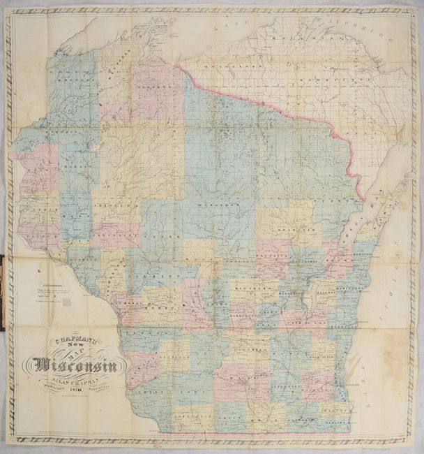
Subject: Wisconsin
Period: 1870 (dated)
Publication:
Color: Hand Color
Size:
30.5 x 32.4 inches
77.5 x 82.3 cm
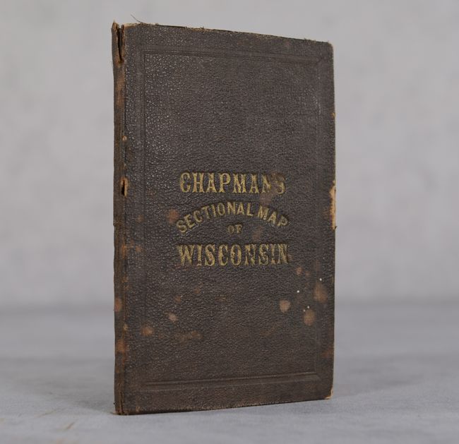
This scarce pocket map of Wisconsin was produced and lithographed in Milwaukee. Printed on fine banknote paper and hand colored by county, this large folding map is drawn on a scale of 10 miles to the inch and thus contains a wealth of information. The southern portion is well settled with good detail of towns and villages, roads, and more. The railroad network is well developed in the south with the northernmost railroad completed near the town of Lincoln in Eau Claire county. The northern part of the state is mostly unsettled. The Chippewa Indian Reservation on Lake Superior and the Oneida Indian Reservation to the southwest of Green Bay are located. The map carries the copyright date of 1860; this being the updated edition of 1870 as noted in the title. Folds into brown cloth covers (3.6 x 5.7") with gilt title on front cover. Paper label on inside lists other maps published by Silas Chapman.
References:
Condition: B+
Issued folding with some minor foxing and light staining at lower right. Covers have minor staining and wear.