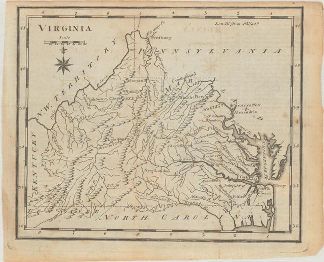
Subject: Virginia & West Virginia
Period: 1795 (published)
Publication: United States Gazetteer
Color: Black & White
Size:
7.3 x 6 inches
18.5 x 15.2 cm
This is the first state of this map that locates settlements but does not give any county names. It includes basic topographical detail and names several towns and cities, including Washington, Richmond, Charlottesville, and Pittsburg. Ohio is still N.W. Territory, and the western boundary with Kentucky incorrectly follows the west fork of the Big Sandy River. This is an early example of cartography produced in the newly formed United States.
References: McCorkle (18th C. Geography Books) #379 [19]; Wheat & Brun #569.
Condition: B+
Issued folding with a few small spots and light toning and offsetting. There is a faint horizontal crease near the middle of the map image.