Subject: Oregon
Period: 1884 (dated)
Publication: Sen. Doc. #60, 49th Congress, 2nd Session
Color: Printed Color
Size:
30.6 x 23.8 inches
77.7 x 60.5 cm
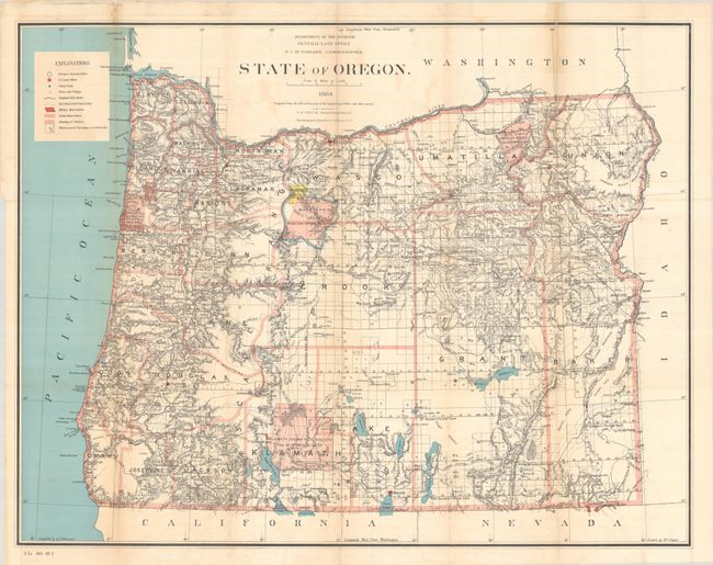
This delicately colored map was drawn by William Naylor under the supervision of G.P. Strum, Principle Draughtsman, N.C. McFarland, Commissioner. There is excellent detail from the Cascade Mountains west to the coast including towns and villages, roads, railroads, rivers and topography shown in hachure. The legend identifies military posts, Indian reservations, completed railroads, railroad land grants, townships and townships not yet subdivided. The granted and indemnity limits of military wagon roads are illustrated. Grid along the bottom indicates longitude west from Washington. Lithography and printing was completed by the renowned Julius Bien firm in New York City.
References:
Condition: B
Issued folding with light toning, minor color offsetting, and an old tape stain (since removed) at top right. There are some tiny splits at the fold junctions and archival repairs to several short fold separations at top, one of which extends 4" into the image.