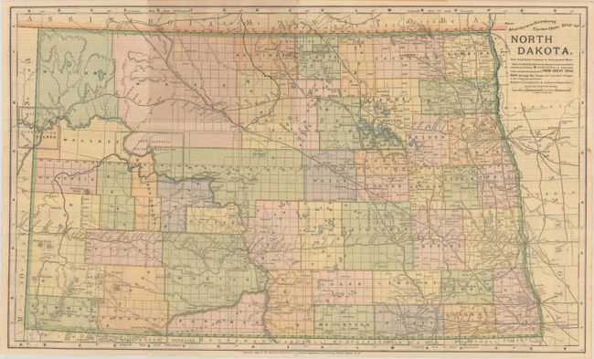
Subject: North Dakota
Period: 1895 (published)
Publication:
Color: Printed Color
Size:
20 x 12 inches
50.8 x 30.5 cm
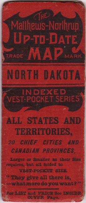
A rarely seen pocket map produced by the same company that created the Century Atlases in the period 1897-1905, with the same remarkably precise engraving and coloring style. It shows the counties, topography, railroads, cities, towns and the progress of the public surveys. A short history, description and index appears on the verso. The map folds into small red, embossed paper covers (2.2 x 5.3") noting this is part of the "indexed vest-pocket series." This was part of Matthew-Northrup's attempt to compete with Rand, McNally's vest pocket series. Evidently the project was not a commercial success, as these maps are very scarce today.
References:
Condition: B+
A clean and bright example with short splits at fold intersections and light toning where the map folded into the covers. The covers are worn with a chip on verso.