Subject: Chicago, Illinois
Period: 1876 (circa)
Publication: Atlas of the State of Illinois
Color: Hand Color
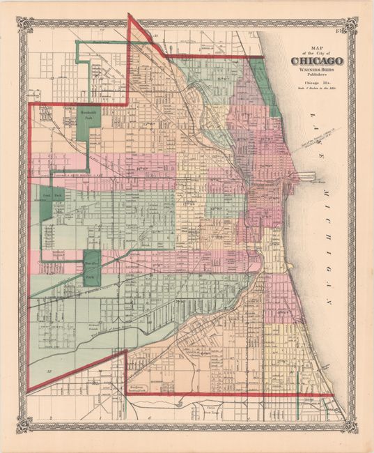
This lot contains two plans of Chicago and surrounding region by the famous Warner & Beers firm, renowned for their state and county atlases. The first (13.8 x 16.8") is an early and very detailed post-fire map of the downtown region. The map extends from Wrightwood Avenue and Fullerton Avenues in the north to the Union Stock Yards and Brighton Trotting Park at Thirty Ninth Street in the south. The map delineates and names all streets. It locates Central Park, Douglas Park, Union Park, Humboldt Park, and Lincoln Park (Jefferson Park has been removed from this edition). The rail lines of several railroads are located and named. The large Government Pier and Light House are drawn at the Chicago River as it enters Lake Michigan. Surrounded by a finely engraved border with blank verso.
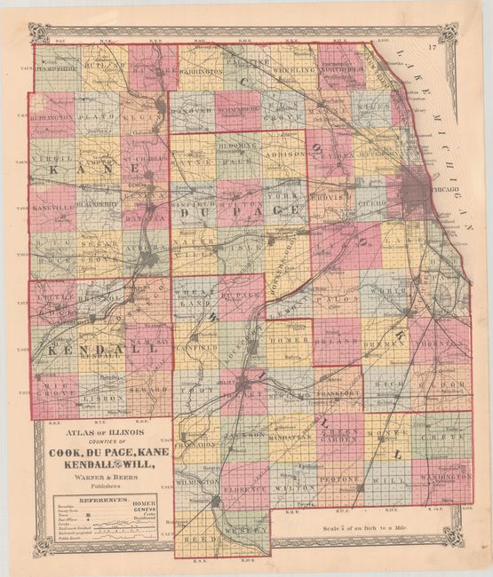
The second map (14.6 x 16.8") provides a wider view of the area naming Deer Grove, Aurora, Joliet and extending south to include Wilmington with the counties of Reed and Wesley below. Each county is individually colored and all towns of any size are shown in grid block style. Excellent depiction of railroads, all named and most entering Chicago. The map also shows a complex network of Public Roads. A nice pair of maps.
References:
Condition: A
Contemporary color. The Chicago map is clean and bright. The county map has light soiling, much of it confined to the margins, and a tear just above the upper neatline that has been closed on verso with archival tape.