Catalog Archive
Auction 203, Lot 236

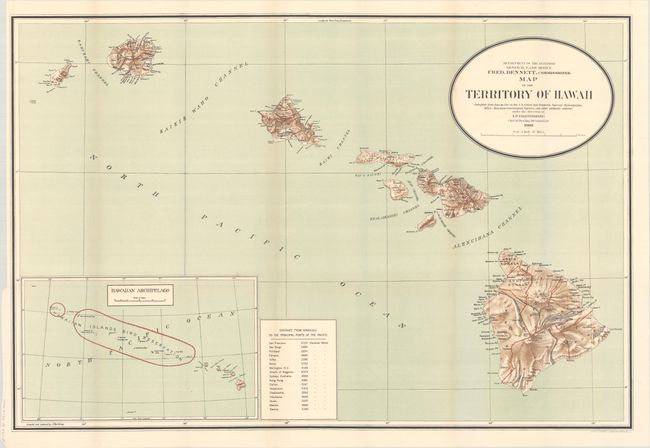
"Map of the Territory of Hawaii Compiled from Data on File in the U.S. Coast and Geodetic Survey; Hydrographic Office; Hawaiian Government Surveys, and Other Authentic Sources...", General Land Office

Subject: Hawaii

Period: 1909 (dated)

Publication:

Color: Printed Color

Size:
32.9 x 22.1 inches
83.6 x 56.1 cm
Download High Resolution Image
(or just click on image to launch the Zoom viewer)

This large and detailed map was "compiled from data on file in the U.S. Coast and Geodetic Survey: Hydrographic Office: Hawaiian Government Surveys, and other authentic sources under the direction of I. P. Berthrong chief of drafting division." It is beautifully colored with lithographic shading to convey terrain. Published under the direction of the commissioner Fred Dennett. A large inset (12.5 x 7.5") at lower left gives a wider view of the entire archipelago and notes in red the Hawaiian Islands Bird Reservation. A small table at bottom gives the distances to the principle ports in the Pacific Ocean from Honolulu.

References:

Condition: A+

Clean and bright, issued folding with tiny holes at fold intersections. The image appears to show toning along the folds, however this is caused by our scanner and doesn't appear on the map itself.

Estimate: $140 - $170

Sold for: $140

Closed on 4/23/2025

Archived