Subject: Florida
Period: 1929 (dated)
Publication: Florida State Geological Survey - Twentieth Annual Report
Color: Printed Color
Size:
31.3 x 30.3 inches
79.5 x 77 cm
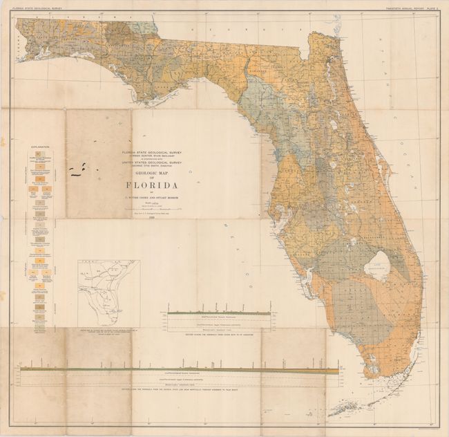
This large-scale map of the state was produced by C. Wythe Cooke and Stuart Mossom and published in the Twentieth Annual Report of the Florida Geological Survey. The detailed map presents 18 different geological types through both color and texture, covering the Eocene to Quarternary periods. The base map was supplied by the USGS and provides the reader with additional detail on rivers, lakes, swamps, railroads, and much more. Features two cross-sections at bottom: Cedar Keys to St. Augustine and Georgia State Line to Palm Beach. We found only two past sales records for this 1929 map (both at Old World Auctions).
References:
Condition: B
Issued folding with several short splits at the fold junctions with some minor image loss at a few junctions. There is soiling along five fold panels and minor pencil notations in the image.