Subject: Eastern California & Northwestern Nevada, Lake Tahoe
Period: 1879 (dated)
Publication: U.S. Geographical Surveys West of the 100th Meridian
Color: Printed Color
Size:
19.1 x 31 inches
48.5 x 78.7 cm
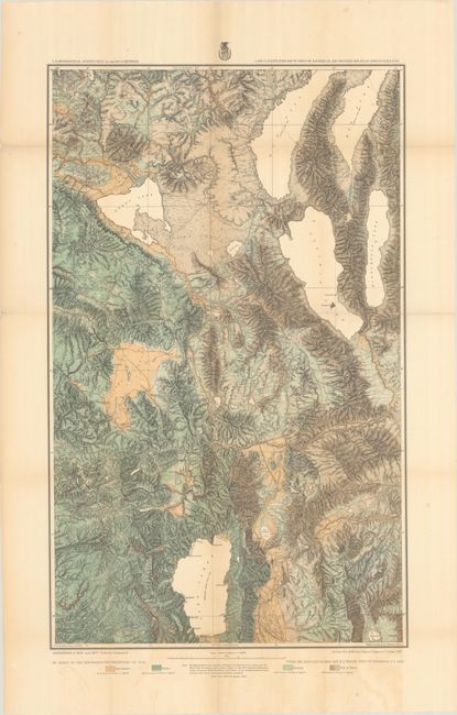
This map is from Wheeler's series of maps showing land classification by type including Agriculture, Timber, and Grazing, as well as Arid or Barren. From the 1877 survey, this large map locates Reno, Carson, and Virginia City. It covers portions of the drainage basins of the Feather, Yuba, American, Truckee, and Carson rivers; Tahoe, Pyramid, Winnemucca and Honey lakes and the so-called Mud Lakes; also the country in the vicinity of the Comstock Lode and that portion of the Sierra Nevada through which the Central Pacific Railroad passes. Finely colored in green and ochre with varying line.
References:
Condition: B+
Issued folding with minor toning along a few folds and light color offsetting in the bottom margin. There are some fold separations that have been closed on verso with archival materials, with a few tiny losses in map image.